
07974 308 637
About Harlo Surveys
Harlo Surveys combines modern survey technology with extensive experience across property, leasehold, and asset management. Our approach is focused on delivering clear, reliable information that supports confident decision-making across the built environment.
Our background in property and asset management means we understand why survey information is being commissioned, not simply how to capture it. Each project is approached around how the information will ultimately be used — whether for design, refurbishment, condition assessment, planned maintenance or asset records.
5+ Years Experience | 750+ Projects | 1,000+ Flight Hours | Nationwide Coverage
GVC | PDRA01 | A2 CofC | Project-specific RAMS | Professional Insurance

Technical Survey & Inspection Services
Using a combination of terrestrial laser scanning, drone data capture, and structured digital reporting, we provide measured surveys, inspection services, and visual data outputs tailored to professional project requirements.
Deliverables include:
-
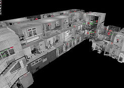
3D point clouds
-
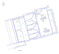
2D floorplans and elevations
-
Inspection and condition reporting
-
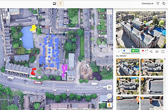
Interactive map-based image access
National Coverage
Delivering survey and inspection services across commercial, residential, and mixed-use environments throughout the UK.
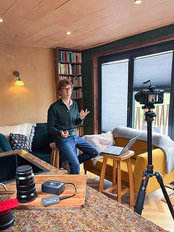
Industry Experience
Practical knowledge shaped by extensive experience across property and asset management.
Measured Surveys
Accurate data capture tailored to the specific requirements and level of detail of each project.
Bespoke Viewing Platform
Interactive Viewing – GPS-linked imagery and map-based access through our online survey viewing platform.
Designed Around Clarity
All survey data is delivered with usability in mind. Through our online viewing platform, clients can access GPS-linked imagery, structured reporting, and clear visual context in a simple, centralised environment.
Our background within property and asset management informs the way we approach every project — combining technical capability with a practical understanding of how survey information is used in real-world environments.